Virginia's Physiographic Provinces
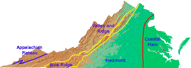
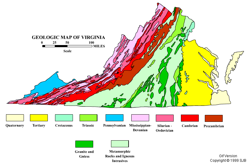
Physiographic provinces are regions characterized by similar geology and geologic history. As seen in the images above, there are five distinct provinces in Virginia and the geologic map below it shows five distinct regions of geology. The science behind these provinces is called geomorphology, or "the study of Earth's forms."
|
Appalachian Plateau
The smallest of Virginia's provinces, the Appalachian Plateau makes up for lack of size with abundance of coal. All of Virginia's coal comes from this region. Coal accounts for more income to the state than all of the other natural resources combined. The geology is sedimentary rocks from the late Paleozoic Era. The topography is generally flat with deep valleys carved by rivers through the soft sedimentary rocks at high elevations. |
Valley and Ridge
The Valley and Ridge is Virginia's karst region. Karst topography is a landscape characterized by sinkholes and caves formed by water dissolving underlying rocks. The rock in question here is limestone formed in the middle Paleozoic Era. Almost all of Virginia's caves are found in the Valley and Ridge. The topography is explicitly given by the name: valleys and ridges. Long ridges with wide valleys between them give the state a wrinkled appearance from above in this region. |
Blue Ridge
The Blue Ridge is the oldest (geologically) area of the state. The tall mountains are created by igneous and metamorphic rocks. The mountains were formed when Pangaea was created about 250 million years ago, but the oldest rock in the region dates back to about 1.2 billion years ago. The province is the widest at the southern end and pinches at a bottleneck at Roanoke. From there, it is a thin strip of blue, hazy mountains through the rest of the state. |
Piedmont
Virginia's largest province is the one my students and I call home. The word literally means "foothills" and thus we live in the foothills of the Blue Ridge. The Piedmont is characterized by metamorphic rocks forming gently rolling hills. The eastern terminus of the region is called the fall line where waterfalls suddenly exist as you first encounter rocks moving upstream from the coast. The only fossils found here are dinosaur tracks in small lenses of Mesozoic aged sedimentary deposits, though no dinosaur bone or tooth has ever been discovered in Virginia. |
Coastal Plain
Possibly the most important province for judging the health of the ecology of Virginia, the Coastal Plain straddles the Chesapeake Bay. Relatively flat, compared to the other provinces, the Coastal Plain is made of recent marine sediments deposited within the last few millions of years when sea levels were significantly higher. Our state fossil, Chesapectens jeffersonius, is found in relative abundance in this region. There are no actual rocks found in the Coastal Plain, except for gravels washed downstream in the major |
